ABOUT
About this spot
Lake Mashu is a caldera lake in Teshikaga, Kawakami District, Hokkaido, within Akan-Mashu National Park. It covers about 19.22 square kilometers and is about 19.8 km around. The maximum depth is about 211.5 m, the mean depth about 137.5 m, and the surface lies at about 355 m above sea level. It is said to have formed in a huge eruption about 7,000 years ago, and the surrounding caldera walls stand at around 600 m above sea level.
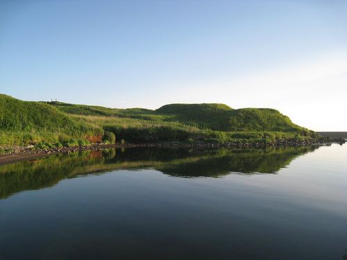
Near the center floats Kamuishu Island, also called Nakajima. It is a lava dome rising more than 210 m above the water, and from the observation decks the small silhouette of the island resting quietly on the deep blue lake is memorable. To the southeast stands Mount Mashu (Kamuinupuri) at 857 m. In the Ainu language it was called Kintan Kamuy To, the lake of the mountain god, and together with the foggy climate it has long been spoken of as a mysterious lake.
Mashu was once known for having some of the clearest water in the world. It is a closed lake with no major river flowing in or out, and this setting is thought to have kept the water clear. The lake lies in a special protection zone, and boats and vehicles are restricted from entering the water. The basic way to enjoy the lake is therefore the view from the observation decks.
There are mainly three decks. The first deck (Mashuko Kamui Terrace) is open all year and about 25 minutes by bus from Mashu Station; it is the standard place to see the lake and the island. The third deck is open only in summer, about 30 minutes by bus, and has fewer visitors. The Ura-Mashu deck is on the north side and has the lowest elevation of the three, so it is sometimes clear when the others are in fog. There is no bus, and it is closed in winter.
The fog forms when warm, moist air from the Pacific is cooled along the Hokkaido coast and the cold fog spills over the rim into the lake. In summer there are many days when the surface cannot be seen, and you meet the scenery that gives the name Misty Mashu. Both the clear blue lake and the mysterious lake hidden in fog are part of the charm.
In autumn the trees on the rim change color, and in winter the snow-covered rim contrasts beautifully with the blue lake. Allow about 30 minutes to an hour at the decks. Fog, snow and road conditions can make the decks or roads unavailable, so please check official information such as the tourist association before you visit. Lake Kussharo and other scenic spots of Akan-Mashu National Park lie nearby, which makes it easy to include in a trip across eastern Hokkaido.
Sources
This article was written from the official, municipal and tourism-association sources above, and checked against them separately from the writing. Editorial policy
Last updated November 21, 2026