ABOUT
About this spot
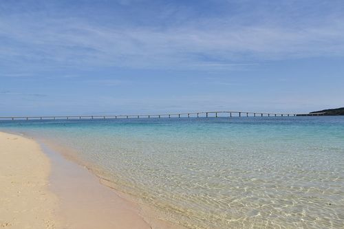
Miyakojima is the main island of the Miyako Islands. In 2005 the former city of Hirara merged with the towns of Gusukube, Shimoji and Irabu and the village of Ueno to form Miyakojima City. Because the island was formed by uplifted coral reef, it has no mountains and is flat almost everywhere. There are no rivers or ponds either: rainwater soaks into the porous coral bedrock and flows underground into the sea. The Miyakojima Tourism Association explains that because little soil washes into the sea this way, the water stays remarkably clear. In the past, island life depended on springs and wells.
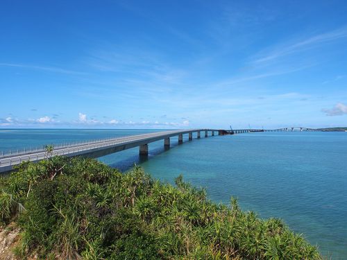
The bridges reaching out to the neighboring islands are among the first things visitors remember. Irabu Bridge, leading to Irabu Island, is 3,540 m long and is said to be the longest toll-free bridge in Japan. Ikema Bridge, 1,425 m long, crosses to Ikema Island in the north and opened in 1992; shops selling Miyako specialties stand at its Ikema end. Kurima Bridge (1,690 m), opened in 1995, links the island to Kurima Island in the southwest, where an observation tower shaped like the Ryugu-jo sea palace stands on high ground and looks out over the beach at Maehama and over Irabu Island.
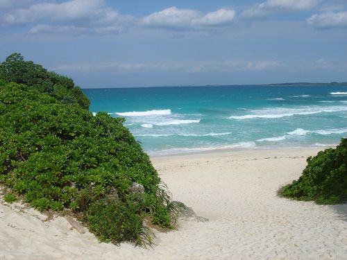
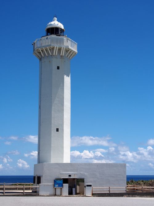
Among the coastal scenery, the white sand of Yonaha Maehama Beach, described by the tourism association as "the finest in the East," is the best known. Higashi-Hennazaki, a slender cape stretching about 2 km from the island's southeastern tip, is ringed by sea cliffs of Ryukyu limestone and is designated a national Place of Scenic Beauty. Strong winds blow all year, so no tall trees grow; instead, wide carpets of Tennoume shrubs cover the ground, and Easter lilies bloom in early spring. Near the tip lies a boulder about 6.8 m across known as the "tsunami stone," and a rock-shelter grave tied to the legend of a tragic love between a local lord and a beautiful girl remains on the cape. From the tip of Nishi-Hennazaki at the island's northwestern tip, you can see Ikema Bridge to the right and Irabu Island to the left at the same time.
The island also offers plenty of places to enjoy the sea. Offshore lies Yabiji, a vast coral reef, and the tourism association also recommends Yoshino Beach and Aragusuku Beach. Toriike on Shimoji Island, which is connected to Irabu Island by bridges, is a pond formed by the erosion of limestone whose bottom connects to the sea; it is a national Place of Scenic Beauty and Natural Monument and a well-known diving spot. At Shimajiri you will find the largest mangrove forest in the Miyako Islands, home to five species including Yaeyama hirugi.
Miyakojima is also called an "island of prayer," and its sacred sites, known as utaki, are still carefully kept. Some are off limits, so follow local signs and visit respectfully. Distinctive traditions live on as well, such as Paantu, the visiting-deity ritual of the Shimajiri community, and Miyako jofu, a fine ramie cloth designated a national traditional craft.
As for food, mangoes, of which Miyakojima is said to be Japan's largest producer at the municipal level, are the taste of summer, and you can also enjoy Miyako soba and fresh skipjack tuna caught by pole-and-line fishing and landed the same day. The island is often affected by typhoons, so if you visit between summer and autumn, keep a close eye on the weather forecast.
Sources
This article was written from the official, municipal and tourism-association sources above, and checked against them separately from the writing. Editorial policy
Last updated November 12, 2026