ABOUT
About this spot
Kunigahama Coast is a scenic area on the northwest side of Nishinoshima in the Oki Islands, Shimane Prefecture. It is a coastline formed when the outer wall of the rim of the Dozen caldera was eroded by waves and wind, and sea-eroded cliffs 200 to 250 meters high continue for about 13 kilometers. Besides the sea cliffs, visitors can see natural arches and candle-shaped rocks. It was designated a Place of Scenic Beauty in 1938 (Showa 13) and a national park in 1963 (Showa 38), and is now part of Daisen-Oki National Park. It is also included as a geosite of the Oki UNESCO Global Geopark.
At its center is Matengai, a cliff 257 meters high, known as one of the largest sea cliffs in Japan. On top of the cliff spreads pastureland where cattle and horses graze. The contrast between the rugged cliffs and the peaceful grassland is the hallmark of the scenery here. You can stand on top of the cliff and look down on the sea, but cattle and horse droppings may be found on the walking path.
Another highlight is Tsutenkyo, at the southern end of the coast. It is a natural sea arch carved out of the rock by the waves, and the whole of it can be seen from the walking path. The path from Matengai to Kuniga-hama is about 1 kilometer in straight-line distance with an elevation difference of about 250 meters, and the climb is said to take about 60 minutes and the descent about 45 minutes.
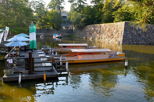
If you want to see it from the sea, there are sightseeing boats that tour the Kunigahama coast, letting you look up at the cliffs and caves from the water. The boats usually run from late March to around mid-November and the town buses from late March to around October, but the periods and days vary, so please check before you use them.
The Akao Observatory, a viewpoint on top of the cliffs, is introduced as a sunset spot that can be reached by car, and from it you can see sea cliffs including Matengai across the inlet. Pastureland spreads around it, and you may come across cattle and horses eating grass. During the Second World War, a facility for watching ships sailing the Sea of Japan was built on top of the cliffs, and its remains can still be seen.
Nishinoshima is one of the inhabited islands that make up Dozen, together with Nakanoshima (Ama Town) and Chiburijima (Chibu Village). Dozen is a volcanic collapse landform (caldera), and the part corresponding to its outer rim is the Kunigahama Coast. The scenery changes with the weather, and bus and boat services are limited, so please check official information before you visit.
Sources
This article was written from the official, municipal and tourism-association sources above, and checked against them separately from the writing. Editorial policy
Last updated November 12, 2026