ABOUT
About this spot
Shiramizu Falls is a ribbon of white water that drops in a straight line through a valley of primeval forest, in the foothills of Mount Haku. It hangs in the Shiramizu Valley in Shirakawa Village, Gifu Prefecture, and belongs to the Ōshirakawa River in the Shō River system. Sources give the drop as anywhere from 67 to 76 meters, with 72 meters the figure most often cited; the width is 8 meters, and the water falls vertically down a sheer cliff surrounded by deep woods as a single stream. The name comes from the milky-white color of the falling water.
At one time the falls was counted among Japan's three great waterfalls. There is no official body that makes this selection, and Kegon Falls, Nachi Falls and Fukuroda Falls are the ones generally named, so the list varies, but it shows how well known the falls was. After being designated a Place of Scenic Beauty by Gifu Prefecture, it became a nationally designated Place of Scenic Beauty in 2024, following a report by the Council for Cultural Affairs in October 2023.
The volume of water has a story of its own. In 1963 the Ōshirakawa Dam was completed in the neighboring valley, and water began to be drawn off upstream of the falls. Because the dam regulates the flow, the falls no longer has the force it once had. In winter all the water is sent to the dam and the falls stops; it can be seen from summer to autumn, when water is released for sightseeing.
The base for visiting the falls is the Shiramizu Falls parking lot. From the parking lot, which holds 20 cars, a walking path leads down to the viewing deck in about 5 minutes. From the deck you look straight at the falls, and on a clear day the summit of Mount Haku is said to be visible above it. The round trip on foot takes only about 10 minutes, but the return is uphill, so comfortable shoes are a good idea.
The best time is mid to late October, when the white falls stands out against the autumn colors of the primeval forest. The fresh green of early summer is also said to be beautiful. Note that Prefectural Route 451 (Hakusan Kōen Line), which leads to the falls, is closed for winter from around the end of October to early June. Check road closures and water-release conditions with the Shirakawa Village tourism office before you go.
Getting there is mainly by car. From the intersection north of Ōshirakawa Bridge on Route 156 (Hakusan Kaidō), drive west on Prefectural Route 451; it takes about 30 minutes to reach the parking lot. It is about 29 km from Shirakawa-go IC on the Tokai-Hokuriku Expressway, and about 40 minutes by taxi from Shirakawa-go if you use public transport. About 400 meters west-northwest of the falls is the trailhead of the Hirase route up Mount Haku, and Lake Shiramizu, created by the Ōshirakawa Dam, and the Ōshirakawa campground are also nearby.
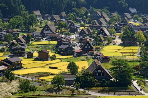
Because other sights are some distance away, it is realistic to fit the falls into a half-day outing. Combine it with Ubagataki Falls about 12.7 km away in a straight line, Shirakawa-go about 14.7 km away, and Bokka no Sato about 19.9 km away, and you can enjoy both the nature and the way of life of Shirakawa Village.
Sources
This article was written from the official, municipal and tourism-association sources above, and checked against them separately from the writing. Editorial policy
Last updated November 16, 2026