ABOUT
About this spot
Sogi Falls lies on the upper Kawauchi River in Isa City, Kagoshima Prefecture. The drop is only about 12 meters, but the falls stretch roughly 210 meters across, and the river spreads over the full width as it pours down. This breadth has earned it the nickname "the Niagara of the East."
The bedrock around the falls was formed from deposits of the Kakuto pyroclastic flow. Rock terraces such as Senjojiki can be seen nearby, and the area is a designated zone of the Sendaigawa River Basin Prefectural Natural Park. A local tradition also says that Toyotomi Hideyoshi admired this scenery on his way back from his campaign against the Shimazu clan.
The area around the falls has been developed as Sogi Falls Park, with a tourist information office, the Shimizu Shrine, eateries and souvenir shops. The shrine is known as a place to pray for good relationships, and its heart-shaped ema plaques have drawn attention. The park is colored by cherry blossoms and azaleas in spring and maples in autumn, and a Maple Festival has been held in late November each year, though what is offered, or whether anything is held, changes from year to year. At the viewing spot stands a monument inscribed with a poem that Yanagiwara Byakuren wrote when she visited the falls in 1957.
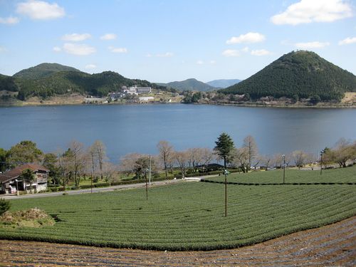
On the shore of Lake Otsuru, about 1.5 kilometers downstream, stand the brick remains of the former Sogi Power Plant. This hydroelectric plant was built in 1909 to supply power to the Ushio-Oguchi gold mine; it became a nationally registered tangible cultural property in 2006 and is also certified by the Ministry of Economy, Trade and Industry as a modern industrial heritage site. Because it lies submerged in the reservoir of the Tsuruta Dam, it appears only from early summer into autumn, roughly May to September, when the dam lowers the water level in preparation for heavy rain, and is under water when the level is high. Across the lake there is an observation park for the remains, from which you can view them over the water. The visible period depends on the dam's water level, so it is wise to check the water-level information before you visit.
Just upstream of the falls there once stood the Sogi Bridge, built by the national government in 1962 as a construction road for the Tsuruta Dam. Because the bridge was seen as spoiling the view, a new Sogi Bridge was built downstream and opened in 2011. After the heavy rain of July 2006 caused major damage across the Sendai River basin, the Sogi Falls diversion channel was built along the left bank for disaster recovery and to reduce flooding. It is about 400 meters long and about 30 meters wide, its course was chosen to minimize any change to the view from the park on the right bank, and its finish makes use of the natural rock surface. In normal times it is a gentle stream carrying agricultural water, and it won a Good Design Award in 2012. In addition, the new Sogi Power Plant, which uses the drop of the falls, has been operating since April 2013. The flow and appearance vary with the season and weather, so please check the latest conditions at the Sogi Falls tourist information office or similar before you visit.
Sources
This article was written from the official, municipal and tourism-association sources above, and checked against them separately from the writing. Editorial policy
Last updated November 12, 2026