ABOUT
About this spot
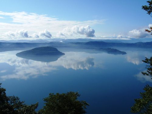
Oirase Gorge lies in Towada, Aomori Prefecture. It is a stream of about 14 km along the Oirase River, running from Nenokuchi on the eastern shore of Lake Towada to Yakeyama in the northeast, and it belongs to Towada-Hachimantai National Park. Lake Towada is a caldera lake, and a great flood that burst out near its outlet is thought to have cut the riverbed and carved a U-shaped valley. The valley was formed by erosion of a plateau of welded tuff, a deposit left by pyroclastic flows.
Named scenic spots appear one after another along the stream. The upper reaches have a continuous series of waterfalls and are also called the Waterfall Road. Choshi Otaki is 7 m high and 20 m wide and is also known as the Fish-Stopping Falls. Kudan Falls drops 15 m. The middle reaches hold the Ashura Stream and Kumoi Falls, and other well-known places include Shiraito Falls, Tamasudare Falls, Ishigedo no Se and Shimeikei. Around Yakeyama downstream the river widens, beech and horse chestnut forest spreads out, and the Oirase Keiryukan stands there.
The forest that covers the valley is another highlight. The main riparian trees are katsura, horse chestnut and Japanese wingnut, and beech and Mongolian oak forests grow on the slopes. Because sunlight is limited on the valley floor, the trees grow tall and spread their roots as if gripping the rocks. Fallen logs, rocks, stone walls and even bridge railings are covered in moss, and in 2013 the Bryological Society of Japan selected the gorge as one of Japan's Important Moss Forests.
This landscape has been protected through a long series of steps. In 1928 it was designated a Place of Scenic Beauty and Natural Monument together with Lake Towada, in 1936 it became part of a national park, and in 1952 it was upgraded to a Special Place of Scenic Beauty and Natural Monument. The conflict between using the water for power generation and irrigation and protecting nature continued for years until the national park was established. Work on the walking path began in 1961, and the path between Yakeyama and Nenokuchi was completed in 1975. National Route 102 runs alongside the stream.
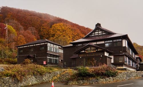
Water from Lake Towada is used for power generation and irrigation, and there is also a system that sends water from tributaries back to the lake to make up for the drop in its level. The roadside station Oirase (Oirase Roman Park) on Route 102 is the eastern gateway, with a waterside park, a lawn plaza and the Oirase Keiryukan. Heavy rain on August 19, 2025 sent sediment onto the path and closed it, but after emergency repairs Aomori Prefecture announced that the whole path would reopen on September 10, 2025. Please check the latest access information before you visit.
Sources
This article was written from the official, municipal and tourism-association sources above, and checked against them separately from the writing. Editorial policy
Last updated October 29, 2026