ABOUT
About this spot
Lake Kasumigaura spreads across southeastern Ibaraki Prefecture. In the broad sense, including Nishiura, Kitaura and the Hitachi-Tone River, its area is about 220 square kilometers, making it the second largest lake in Japan after Lake Biwa. In the narrow sense the name refers only to Nishiura, which covers about 172 square kilometers; Kitaura covers about 36. The average depth is about 4 meters and the maximum only about 7, so it is a wide but shallow lake with a flat bed.
The lake is a former coastal lagoon. It was once brackish, affected by seawater, but became a freshwater lake after the Hitachigawa Water Gate was built in 1963. Its name is said to derive from the “Kasumi no Sato” (village of mist), and in the Edo period the eastward diversion of the Tone River made it a key point for water transport. A naval aviation facility was set up here in 1916, and in 1929 the airship Graf Zeppelin called here, so the lake also has a place in modern history.
The lake’s signature sight is the hobiki-bune, or sail-drawn fishing boat. It is said to have been devised in 1880 by a fisherman named Orimoto Ryohei, and used the force of the wind to drag a net to catch pond smelt and icefish. Each boat carried a single white sail roughly 14 to 16 meters wide and could not fish without wind. It is said to have been used for icefish from around 1885 and adopted for pond smelt around 1889. At the peak, more than 900 boats are said to have filled the lake. Powered trawling pushed the method out as a fishery in the mid-1960s, but it was revived as a tourist attraction in 1971, and about seven boats sail today for sightseeing.
As for fishing, the catch peaked at 17,487 tons in 1978 and fell to 2,416 tons in 2000. The main species are pond smelt and icefish. The lake is also a source of tap water, agricultural water and industrial water, so it is both a sightseeing destination and a reservoir that supports daily life. At the same time, eutrophication has progressed, and algal blooms have been a problem since the 1970s, which is also part of the lake’s reality.
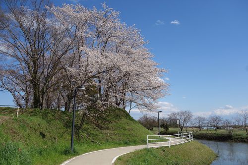
The cycling road along the shore is part of the Tsukuba-Kasumigaura Rinrin Road, which is also designated a National Cycle Route. Between Iwase and Tsuchiura it follows the track bed of the Tsukuba Railway, abolished in 1987, and the whole route is nearly flat, with an elevation difference of only about 51 meters. Scenic spots such as lotus fields and Ayumizaki lie along the route around Kasumigaura, and with the Suigo Tsukuba wide-area rental cycle service you can borrow a bicycle at a rental point and ride.
Sources
This article was written from the official, municipal and tourism-association sources above, and checked against them separately from the writing. Editorial policy
Last updated November 12, 2026