ABOUT
About this spot
Shomyo Falls (Shomyo-daki) is a waterfall in Tateyama Town, Toyama Prefecture, where the Shomyo River, fed by the Tateyama mountain range, plunges from the edge of the Midagahara plateau. It belongs to the Joganji River system. Its drop is given as 350 meters, and it is known as the waterfall with the greatest drop in Japan. The fall is about 10 to 15 meters wide and descends in four tiers of 70, 58, 96 and 126 meters from top to bottom; the pool at the base is said to be 60 meters across and about 6 meters deep. It is designated a national Place of Scenic Beauty and Natural Monument, and it is also listed among Japan's 100 Best Waterfalls and the 100 Soundscapes of Japan.
One account of the name says that Honen, the founder of the Jodo school of Buddhism, heard the roar of the water as the chanting of the nenbutsu prayer.
Beside it appears a second waterfall, Hannoki Falls, which shows itself only seasonally, in spring snowmelt and after rain. Its drop is said to approach 500 meters, but because it does not flow all year it is not normally recognized as Japan's tallest. When the water volume increases further, Somen Falls can also appear on its right.
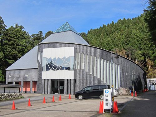
On the way to the falls you pass beneath the cliff known as Akujo no Kabe, a rock wall about 500 meters high and 2 kilometers wide. Some 100,000 years ago the falls are thought to have stood about 15 kilometers downstream, near Omitsuke, and they have retreated to their present position by wearing away welded tuff at roughly 10 centimeters a year. In 2020, a survey by the Tateyama Caldera Sabo Museum confirmed that a new step is forming at the bottom, so the falls are becoming a five-tier fall. On the cliff you can also still see a horizontal tunnel dug in 1945 for a hydroelectric intake, a project abandoned after the war. Upstream lies a great gorge called Shomyo Rokka.
The Hachiro-zaka trail beside the falls was a pilgrimage route to Mount Tateyama and Mount Oyama before the Alpine Route opened, and it still exists. Tateyama Town describes it as a course for experienced hikers, with steep slopes and many narrow or unstable places.
From the parking area, the walk to the falls takes about 30 minutes (1.3 km) along a footpath. Buses from Tateyama Station to the falls run seasonally, so please check the latest bus operation and road access with Tateyama Town or the operator before you visit.
Sources
This article was written from the official, municipal and tourism-association sources above, and checked against them separately from the writing. Editorial policy
Last updated November 12, 2026