ABOUT
About this spot
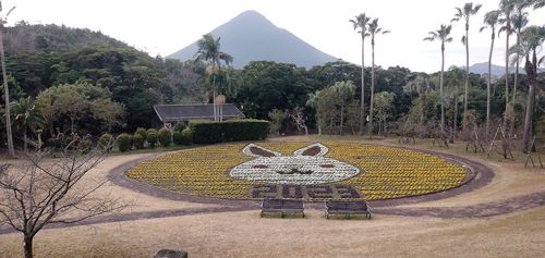
Mt. Kaimon is a volcano rising 924 meters at the southern tip of the Satsuma Peninsula in Ibusuki, Kagoshima Prefecture. Its height was formerly given as 922.23 meters, but it was revised after the Geospatial Information Authority of Japan remeasured it in 2001. Its neatly conical shape has earned it the name Satsuma Fuji, and it is one of Japan's 100 Famous Mountains. In 1964 it was designated part of a national park.
The mountain is built as a basalt stratovolcano topped by an andesite lava dome. From a distance it looks like a single mountain. It began to be active about 4,400 years ago, and major eruptions occurred in 874 (Jogan 16) and 885 (Ninna 1). The lava dome erupted at that time is said to have given the mountain its present two-tiered form. The Hashimuregawa site is known as a site where a settlement was abandoned because of the late ninth-century eruption.
Mt. Kaimon stands at the southern tip of the Satsuma Peninsula and has long served as an important landmark for sea traffic. Together with Mt. Noma and Mt. Kinpo it is called the "Three Peaks of Satsuma." It is a mountain loved as a symbol of Ibusuki.
The climb has an elevation gain of more than 900 meters from the foot of the mountain to the summit. A spiral trail winds around the mountain, which is its hallmark. You submit your climbing notification at Kaimon Sanroku Fureai Park, walk a paved road, and enter the trail at the 2nd station. At the 5th station there is an open lookout with benches and a viewing deck. Near the summit there are rocky stretches, rope sections, and places where you climb ladders. Slippery small stones are common underfoot, so take particular care on the descent. An inner shrine of Mitake Shrine is said to stand at the summit. There are no toilets or water sources on the mountain.
From the summit you can see Lake Ikeda to the north and the sea all around. Even along the trail, the view of the sea opens up as you gain height.
At Kaimon Sanroku Fureai Park, the trailhead, there are toilets, a shop, and a campground.
Sights are scattered around the area. They include Hirakiki Shrine, the first-ranked shrine of Satsuma Province, and Lake Ikeda, a caldera lake about 5 km to the northeast. Nishi-Oyama Station, an unstaffed station said to be the southernmost JR station, is a place where you can see Mt. Kaimon close at hand.
Before you climb, check the weather, trail conditions, and the latest volcano information. Trail conditions can change, so please consult official information as well.
Sources
This article was written from the official, municipal and tourism-association sources above, and checked against them separately from the writing. Editorial policy
Last updated November 12, 2026